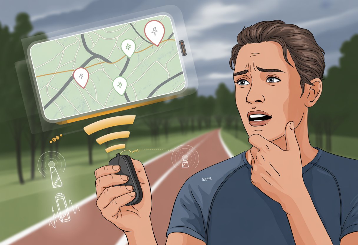
Let’s be real—who hasn’t checked their fitness tracker and discovered they apparently ran through buildings or teleported across town? We’re out here trying to count actual steps, not rack up imaginary leaps across city blocks. Fitness trackers can show inaccurate GPS locations because stuff like tall buildings, bad weather, and low battery mess with their signal.

It’s frustrating to see your hard work turn into some wild, abstract map art. You might even wonder if you should run your route again or just accept your new title as the neighborhood “rooftop jumper.”
But hey, you’re not the only one dealing with this. There are a few tricks to help keep your GPS from going totally off the rails. Why does this keep happening, and can you fix it? Stick around—let’s try to straighten out those zig-zags.
Understanding GPS in Fitness Trackers
Let’s grab a virtual magnifying glass and peek under the hood of these trackers. If you’ve ever wondered why your device acts like a confused tourist, it helps to know how GPS works and what’s actually going on with those satellites.
How GPS Technology Works
When you hit “start workout,” your tracker basically yells, “Hey satellites, where am I?” The GPS inside tries to talk to several satellites floating way above us. They send timing signals, and your tracker does some quick math to figure out where you are.
It’s not just one satellite doing all the work. Your tracker listens for at least four at once. The more satellites it connects to, the better your location accuracy—unless you’re under a bridge, in a tunnel, or surrounded by dense trees. That’s when signals start playing hide and seek.
GPS needs a clear line of sight. If tall buildings or mountains block the way, your tracker basically shrugs and sends your route zigzagging all over the place. The GPS chip inside your device matters too. Some chips, like Sony’s, save battery but might be a bit slower to catch on.
Types of Satellite Systems
“GPS” is the big name, but it’s not the only system out there. Trackers often work with other satellite systems for better accuracy. Here’s a quick peek at the main players:
| System | Country | Nickname |
|---|---|---|
| GPS | USA | NAVSTAR |
| GLONASS | Russia | Fast Track |
| Galileo | European Union | Euro Track |
A lot of trackers now use GPS + GLONASS or GPS + Galileo to stay reliable. More satellites from different systems mean your device has a better shot at keeping your route on track—especially in tricky spots.
Position Acquisition Basics
Before your run, your tracker grabs “ephemeris data”—basically satellite schedules for the day, like a cosmic bus timetable. If this file is old, your tracker might take longer to find satellites or get your position wrong.
Your tracker starts searching for as many satellites as it can. If it hasn’t been outside in a while, it might get a “cold start,” which takes longer. Once it locks onto enough signals, it can finally map your route.
The first minute or two after you hit start is a bit of a GPS guessing game. Giving your tracker a clear view of the sky and a minute to warm up helps avoid wild jumps across lakes or someone else’s backyard.
Common Causes of Inaccurate GPS Location
Some fitness trackers seem to get lost even more easily than we do at a new mall. A few main culprits—like tough environments, weird device placement, and battery quirks—often lead to those squiggly GPS lines. Let’s break down what usually throws our trackers off.
Poor Sky Visibility and Challenging Environments
Trackers need a clear view of the sky, not just for inspiration, but because GPS signals come straight from satellites overhead. Tall buildings, thick forests, and deep city streets block those signals, leaving your device clueless.
Experts say bad weather, like heavy rain or thick clouds, makes things worse. Satellite signals bounce off surfaces or get lost. That’s why your city run sometimes looks like a toddler drew it. Some GPS devices get especially weird near big metal structures or inside tunnels, where signals like to vanish.
If your regular route takes you through trees or a maze of skyscrapers, expect your tracker to throw in some wild zigzags or sudden jumps. Want more on how blocked signals mess things up? Check out this page about common GPS tracking problems.
Device Placement and Orientation
How you wear your tracker makes a difference. If you slap the watch on upside down, tuck it under a thick sleeve, or bury your phone in a gym bag, you’re blocking those precious GPS signals. The signal needs room to breathe—kind of like us after a big meal.
Wearing the device tight and in the right spot—usually the outside of your wrist—helps it pick up signals better. Think of it as giving your tracker a front-row seat instead of hiding it behind a curtain. Accessories like metal jewelry or other gadgets nearby can also confuse your tracker. For best accuracy, let the GPS antenna face the sky and don’t treat your device like fragile treasure.
Battery Life Issues
Low battery turns our fitness trackers into sloths. When the battery’s almost gone, many trackers cut back on GPS to save power. This might mean it skips recording some points, so you get weird straight lines or missing data.
Sometimes, the device switches to low-power modes or uses step counters instead of GPS, which just makes things more confusing. To keep your tracker from “fainting” mid-run, charge it up before you head out. Trackers need plenty of juice to keep up with you—not just pretend. Some devices even flash a warning about low GPS accuracy when the battery’s low, so watch for that. For more battery and GPS tips, check this advice from Garmin.
Technical Issues Impacting GPS Accuracy
Let’s be honest, sometimes your tracker thinks you’re running through buildings or teleporting across the block. There are some tech quirks that mess with GPS—like files that help your device predict signals, or how it locks onto satellites and logs your route.
Ephemeris Data Files and Satellite Pre-Caching
Your tracker doesn’t just grab GPS signals out of thin air. It relies on little info packets called ephemeris data files (or EPO files, or satellite pre-cache files). These tell your tracker where satellites should be in the sky for the next few days. It’s like giving your device a cheat sheet for satellites.
If your watch doesn’t update this file often, it takes longer to find satellites. That means your tracker could start your run by pointing you in the neighbor’s yard. Old EPO files can throw off distance, pace, and route accuracy until the watch catches up. Most brands recommend syncing regularly so your tracker has the latest satellite info. Keeping firmware up-to-date helps avoid classic GPS goofs, making your workout look more like a real route instead of pixel art. For more details, check out this guide about what can cause GPS accuracy issues.
Connected Predictive Ephemeris
Some smartwatches try to get ahead by pre-loading future satellite data when you sync to your phone or Wi-Fi. This is called connected predictive ephemeris. Picture your tracker grabbing a double espresso before your workout so it’s ready to find satellites fast.
When it works, getting a GPS fix is quick. But if your device skips syncing for a few days, it’s guessing satellite locations based on old info. That can make GPS start in the wrong spot or lag behind as you move. Regularly syncing your device keeps the predictive ephemeris file fresh and helps avoid those weird “phantom” routes. For more on this, see how syncing updates the satellite data.
GPS Fix and Track Points
Getting a good GPS fix is kind of like finding friends at a noisy party—your tracker needs to hear at least four satellites clearly to know where you are. If buildings, trees, or clouds block the view, the GPS fix takes longer and might wander.
Once you get a fix, the tracker records “track points” at set intervals. In perfect conditions, those dots follow your real path. But if the signal drops or bounces off buildings, you get zig-zags or sudden jumps. That’s why your activity map sometimes looks like modern art. If you give your device 30-60 seconds to get a solid fix before starting, it usually maps your route better, even in the city. For specific stories about signal problems in cities, check out this discussion about GPS accuracy in cities.
How Workouts and Activity Settings Affect GPS
The settings you tap (or ignore) can actually change how your fitness tracker reads your every step. Different workout types, indoor activities, and how much detail you want in your logs all play a part in GPS accuracy.
Running Versus Walking Versus Cycling
When you tell your device if you’re running, walking, or cycling, you’re not just being polite—you’re helping it get your GPS right. Runners move faster, so trackers check location more often. That should make your run routes look more like the roads you actually ran.
Walking gets sampled less often because you’re moving slow. This can make your walks look like you teleported from one place to another, which is either hilarious or kind of annoying.
Cycling is a bit different. You usually move fast and cover more ground, so GPS updates happen at higher rates. This extra attention means your bike rides usually show a more detailed path. But if you’re stuck at every red light, your tracker might think you’re teleporting around town.
Treadmill Mode and Indoor Scenarios
When you pick treadmill mode, most fitness trackers ditch GPS and lean on sensors like accelerometers and gyroscopes. These try to count your steps and estimate how far you’ve gone. Sometimes, “estimate” really is the best word for it.
Inside a gym or your basement, GPS can’t help much. Concrete walls, Wi-Fi routers, and even your fridge can mess with accuracy. That’s why you might see your device claim you ran half a marathon just chasing your dog around the living room for five minutes.
If you calibrate your device, it learns your stride and gets a little better at guessing treadmill distance. This helps, especially when GPS is out of the picture. Apple Watch users can follow these steps to calibrate their workouts when running indoors.
Activity Resolution and Distance Traveled
Activity resolution decides how often your fitness tracker grabs data during a workout. When the device uses high resolution, your route looks smoother and more accurate. If it uses low resolution, your path turns jagged, as if you leapt over buildings in one go.
If you care about your stats or want to know exactly how far you traveled, this setting matters. It affects not just your workout map, but also the total distance you ran, walked, or cycled. Low resolution can skip small turns or side paths, so your numbers might be off.
Some trackers let you lower the resolution to save battery during long workouts. Sure, your device lasts longer, but your three-mile run could end up looking like a toddler’s connect-the-dots drawing.
Device Compatibility and Brand Differences
It’s wild how two friends on the same sidewalk can get totally different GPS results. Each brand, and even each model, has its own way of measuring distance, dealing with weak signals, and deciding where exactly you are.
Garmin Forerunner and Garmin Edge Specifics
With Garmin, sometimes it feels like playing GPS bingo. Forerunner and Edge devices are favorites for runners and cyclists, but they still have quirks.
Some models find satellites fast, while others take their time. If you go under thick trees or through tall buildings, these devices might record wobbly or zigzag routes. This messes up pace, distance, and even calorie counts.
Garmin says your track and distance might look off if the GPS signal isn’t strong. Keep your device away from metal and electronics, and don’t wear your Forerunner under a thick jacket. That helps a lot.
Check for software updates often, because Garmin seems to release bug fixes on a never-ending loop.
Polar Vantage and Wahoo Rival Features
Polar and Wahoo do things their own way. The Polar Vantage uses advanced satellite tracking, but it still struggles with pace on twisty routes or in big groups.
Wahoo Rival is built for triathletes and tries to track smooth transitions between activities. Honestly, it handles open water swims better than most. If you bury your Rival under sleeves or gear, though, the GPS can glitch, leaving odd spikes or gaps in your data.
Both brands suggest wearing the device high on your wrist and keeping the antenna clear. Sometimes, just switching wrists makes a difference.
Smartphones and Bluetooth Smart Connectivity
Relying on a smartphone for GPS over Bluetooth Smart can be a gamble. Sometimes it works great, sometimes your data just disappears. Many trackers use your phone’s GPS by syncing with Bluetooth.
If your phone has GPS issues, sits deep in a pocket, or runs too many apps, problems show up. If Bluetooth drops or your phone is buried in a bag, you might lose data or see delays.
If you’re sharing your activity with friends, don’t be shocked when your stats don’t match. Device position, Bluetooth hiccups, and different phone models all play a part. In tech, “close enough” is often the best you can hope for. For even more reasons why your data might vary, check out this device differences and data variation breakdown.
Troubleshooting Tips for Better GPS Performance
Before you throw your tracker out the window, let’s see what’s messing up your location data. Good GPS isn’t magic—it’s about signal, your device, and, unfortunately, the update you skipped last week.
Ensuring Accurate Position Information
Honestly, sometimes our trackers get confused because we don’t help them out. When you start an activity, stand still for a moment. Pacing around and waving your arms just makes things harder for the GPS.
Turn on Location Services. Double-check that you’ve picked the right activity mode—you don’t want your run logged as a swim.
Keep your tracker out in the open, not hidden under sleeves or stuffed in a bag. Fabric and obstacles can mess with the signal, and your device might send you on a virtual tour of your neighbor’s yard. If your tracker lets you pick a satellite system like GLONASS or Galileo, turn those on for better accuracy.
Improving Satellite Signal Strength
GPS likes clear skies and open spaces. Tall buildings, thick woods, or being indoors can throw everything off. If you want a clean route map, step outside before hitting “Start”.
Try these tips:
- Wait for the GPS to lock before you start moving. Patience pays off.
- Keep your tracker snug, but not too tight.
- Stay away from big metal objects or strong Wi-Fi routers, since these can cause GPS drift.
If your data looks like you zigzagged through every yard on the block, your signal probably wasn’t strong enough.
Firmware and Software Updates
Those update reminders? They actually matter. Old firmware can leave your tracker clueless about new satellites and cause GPS bugs.
Check for firmware or app updates on your phone and tracker regularly. Sometimes, updates fix signal handling or add satellite support.
Using the latest version means your tracker has the newest tips for fixing location issues. If you’re still having trouble after updating, check the manufacturer’s troubleshooting pages, like Garmin’s help on accuracy issues.
Integration with Fitness Apps and Platforms
Let’s be real—our GPS trackers don’t always play nice with every app. When you send your sometimes weird-looking route into other apps or try to check how much elevation you really climbed, things might get even stranger.
Syncing with Strava
When you sync your fitness tracker with Strava, it can feel like sending a message by carrier pigeon. You expect your runs to show up with flawless GPS lines, but Strava can be picky. If your tracker’s GPS dropped out for even a second, your map might turn into modern art.
Elevation data is another headache. Strava reads GPS and elevation its own way, so your tracker’s numbers might change during upload. No, you’re not climbing Everest just because Strava says you gained 3,000 feet circling the block. The difference comes from how Strava “fixes” and interprets data from different devices, so your route or distance might not match. For more on this, see why different apps give different distances.
Exporting and Analyzing GPS Data
Exporting GPS data always feels a bit like playing detective. Usually, we download files in formats like GPX or TCX, then open them up in apps or websites built for analyzing routes.
It’s honestly fun until you realize your “straight line” to the grocery store somehow looks like you wandered all over town.
When we dig into the exported data, quirks pop up fast. Sometimes, the route skips turns.
Other times, random elevation spikes show up where there’s just a speed bump, or the map drops you straight into a river. If you open and compare exported files with different apps, you’ll see not all systems handle details in the same way.
Some platforms, like Fitbit, might report the right distance but draw some seriously odd paths. You might laugh, or maybe sigh, but at least there’s proof of your adventures—even if the data claims you trekked through someone’s backyard.
- How to pair Bluetooth headphones with a smart TV and avoid waking up your entire neighborhood - January 26, 2026
- How to Use a Fitness Tracker for Dance Workouts: Bust a Move Without Missing a Step Count - January 26, 2026
- Why is my fitness tracker not counting steps? Top Reasons You’re Accidentally a Couch Potato - January 25, 2026


